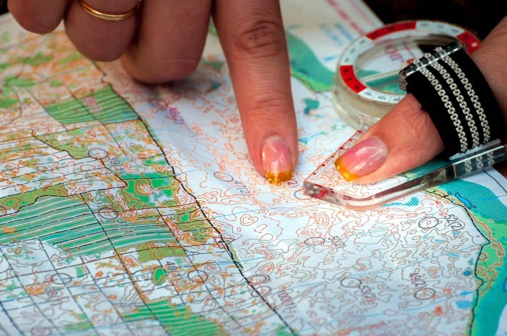
The importance of maps can hardly be overestimated when it comes to orienteering. Especially considering the fact that maps for orienteering are very detailed, and that runners are completely dependent on them. While regular maps could serve their purpose for many, many years, an orienteering map needs to be updated more often.
Up-to-date details required
A major difference between regular maps and maps for orienteering is that orienteering maps are topographic. If the runner cannot detect the hilly parts before he or she gets there, it is obviously harder to optimize a route for the course. Compared with topographic maps for general-purpose uses, these maps are incredibly more detailed.
The maps, which usually are 1:10 000 or 1:15 000 scale, contains information which could change in a relatively short amount of time. Small fences, trails, and earthen banks, for instance, are things that a runner needs to know about before (or while) orienteering. A map that is a couple of years old can easily contain misleading information.
Features
Of course, the choice of features in an orienteering map is highly dependent on the terrain. While many competitions are held in forests, some take place in more urban areas. There are however some features that are more common than others. For instance:
- Rock features. Objects such as rocks, cliffs, boulders and boulder fields are sorted under this category. These features are common in the Munkedal Middle Distance race, for example.
- Water features. These features are marked in blue and cover lakes, ponds, and wells (among others).
- The colour that marks vegetation varies. The colour white marks an open runnable forest, while green marks an area with low visibility and reduced running speed. The colour yellow shows open areas. If the green areas of the map have green vertical stripes on them, it means that visibility is good, but reduced running speeds are still to expect because of undergrowth.
In the early days
When orienteering still was a new phenomenon, runners typically used whatever maps they could get their hands on. In many cases, these were topographic maps from a national mapping agency. Even though national mapping agencies normally update their maps regularly, competitors would find them to be insufficient for the purpose of orienteering.